
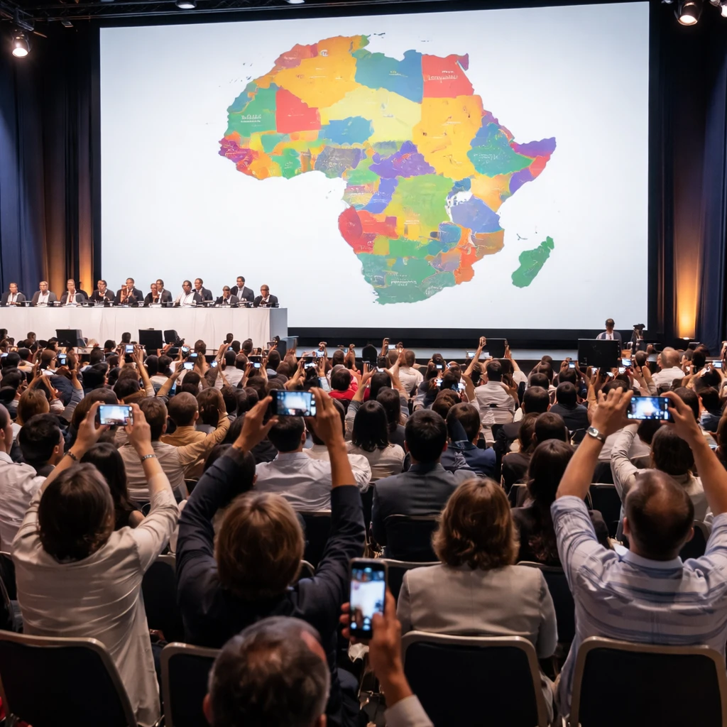
A U.S. government slide displayed at the AIDS 2026 conference in Rio de Janeiro featured a map of Africa that incorrectly located every country on the continent, drawing immediate attention from attendees who photographed and shared the image online.
The map appeared midway through a State Department presentation on new health agreements. Video of the session reviewed by Reuters shows the erroneous graphic shown while the speaker discussed initiatives under the President's Emergency Plan for AIDS Relief, known as PEPFAR.
An analysis of the presentation image found an artificial intelligence watermark that indicates the graphic was produced with OpenAI tools. OpenAI did not respond to a request for comment made in connection with that finding.
In response to the circulating images, the State Department said it "takes full responsibility" for the confusion and misrepresentation the slide caused for conference attendees, including African partners. The department said the map had been generated by a team member who rapidly modified the slide deck ahead of the event.
The mislocated countries on the map were striking. Nigeria - a country where the United States currently has several hundred troops deployed - was shown as landlocked and positioned in the Sahara Desert. Mozambique, correctly situated in southeastern Africa, had been moved to the Horn of Africa, while Ivory Coast, a West African nation, appeared on the opposite side of the continent.
Screenshots of the inaccurate map were first published in a Substack post by AIDS expert Emily Bass and rapidly spread on LinkedIn, where one post reached roughly 40,000 views. Commentators, including experts who focus on AI and geopolitics, criticized the slide, arguing that the mistake demonstrated a lack of basic geographic verification by those who produced and approved it.
The speaker at the session was Jeff Graham, the senior U.S. health envoy overseeing PEPFAR. He did not respond to requests for comment about the slide.
Despite the map controversy, the State Department said the conference discussions remained "substantive and constructive" and reiterated the United States' commitment to combating AIDS and producing measurable results. The statement noted that while PEPFAR's core work - such as supplying life-saving medicines - has largely resumed following last year's pause in funding for a review, the U.S. is reducing spending in other areas including prevention and surveillance and plans to fully phase out the program in South Africa.
Contextual note: The event and the slide drew attention not only for the geographic errors but also for the apparent use of an AI-generated image in an official presentation, raising questions about review processes for materials used in diplomatic and health engagements.