
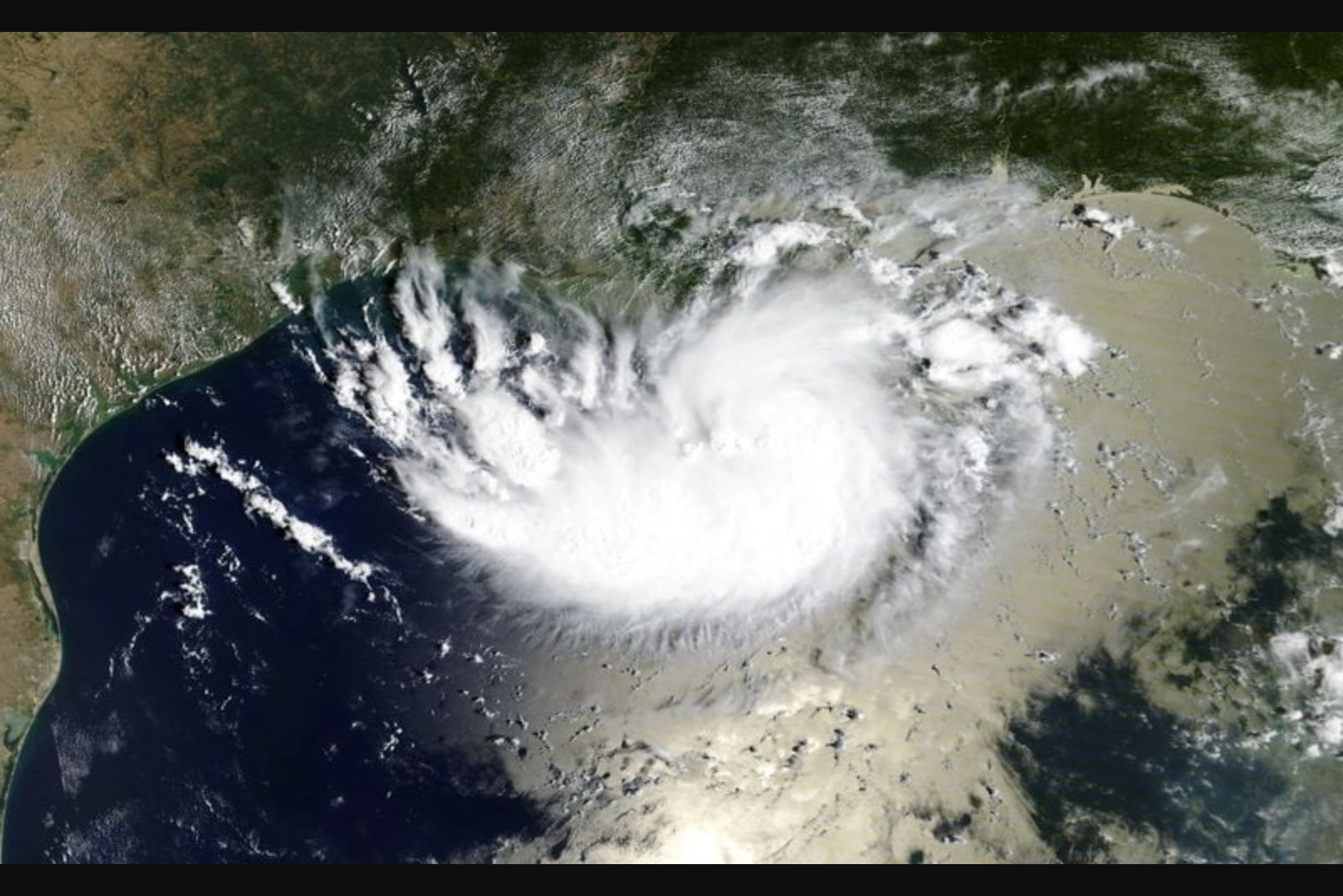
Overview
On Sept. 1 Tropical Storm Edouard emerged from the central Gulf of Mexico and made landfall near the Texas-Louisiana border, arriving with sustained winds of up to 60 miles per hour and heavy rainfall. The National Hurricane Center in Miami reported that Edouard made landfall near Johnson Bayou in the southwesternmost corner of Louisiana at about 2:20 p.m. Central time (1920 GMT). After coming ashore, the storm veered west and pushed gale-force winds and intense downpours into southeastern Texas.
Rainfall and flooding concerns
Forecasters noted that Edouard was carrying a substantial amount of moisture siphoned up from warm Gulf waters. The hurricane center said as much as 9 inches of rain could fall along the storm's inner path from the coastline into east-central Texas. Officials warned that the heavy, localized downpours could produce flash flooding in affected communities.
Forecasted weakening
Authorities expect the storm's core to weaken quickly as it moves further inland. The National Hurricane Center said Edouard should diminish to tropical depression status by early on Wednesday as loss of access to Gulf energy and warmer waters reduces the system's intensity.
Local impacts and energy sector response
Utilities reported that more than 4,000 homes and businesses in southeastern Texas experienced power disruptions as the storm moved inland. There were little if any reports of direct consequences to Gulf Coast oil and gas production at the time, though people familiar with operations at regional energy plants said East Texas refineries took steps to secure their facilities ahead of the storm.
In a statement released before landfall, Shell said: "We are closely monitoring Tropical Storm Edouard. At this time, we do not anticipate weather impacts to production or drilling."
Season context
Edouard is the fifth named storm of the 2026 Atlantic hurricane season, which runs from June 1 to November 30. According to the information available, none of the season's named storms so far have reached hurricane strength.
Key points
- Tropical Storm Edouard made landfall near Johnson Bayou, Louisiana, at about 2:20 p.m. Central time (1920 GMT) with sustained winds of up to 60 mph and then moved west into southeastern Texas.
- Forecasters warned of up to 9 inches of rain along the storm's inner path from the coast into east-central Texas and cautioned that heavy downpours could cause local flash flooding.
- More than 4,000 homes and businesses in southeastern Texas lost power; energy firms reported precautionary measures at East Texas refineries, while Gulf Coast oil and gas production showed little if any reported effect.
Risks and uncertainties
- Flash flooding from localized heavy rainfall poses a near-term risk to communities and infrastructure along the storm's projected path - this affects residential areas and local services in southeastern Texas and coastal Louisiana.
- Power outages are an immediate operational risk for utilities and customers in southeastern Texas, where more than 4,000 service connections were reported disrupted.
- While Gulf Coast oil and gas production was reported to have little if any consequence at the time, energy facilities may face operational uncertainty if conditions change; East Texas refineries took precautionary steps ahead of the storm.
Note: The information above reflects reports and forecasts available at the time; the National Hurricane Center provided the timing, wind, and rainfall guidance summarized in this report.