JAKARTA, April 2 - A powerful earthquake with a magnitude of 7.4 struck the Northern Molucca Sea near Indonesia's Ternate island on Thursday, authorities and witnesses reported. The event produced aftershocks, damaged structures in parts of the region, and triggered tsunami waves that were observed at coastal monitoring stations.
The United States Geological Survey recorded aftershocks reaching magnitudes as high as 5. Indonesia's meteorological agency BMKG reported measured tsunami waves of 0.3 meters in West Halmahera and 0.2 meters in Bitung.
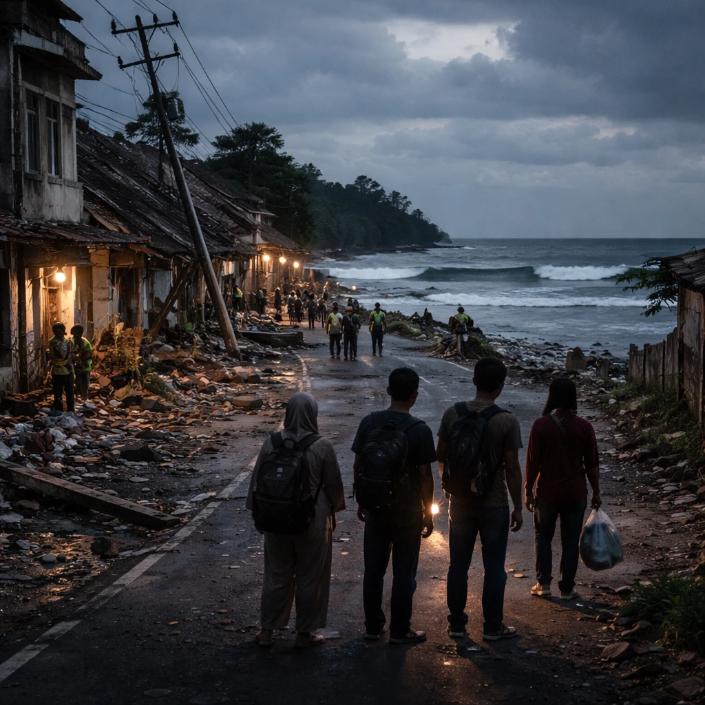
Local broadcaster Metro TV reported at least one fatality in the Manado area caused by falling rubble and showed video footage of damaged buildings. A resident of Manado said people fled their homes in panic; in her neighbourhood there was no obvious structural damage, but household items had fallen from shelves and power had been cut.
Warnings and regional monitoring
Regional authorities on some islands, including Ternate and the nearby historic Spice Island of Tidore, were urged to prepare residents for potential evacuations. U.S. tsunami warning authorities cautioned that hazardous tsunamis were possible along coastlines of Indonesia, the Philippines and Malaysia within 1,000 km (620 miles) of the quake's epicentre.
The quake's epicentre was located roughly 580 km south of the Philippine coast and about 1,000 km from Malaysia's Sabah. Based on the latest data available, the Philippines' seismology agency Phivolcs said there was "no destructive tsunami threat" to the country.
Malaysia's meteorological department posted on Facebook that there was no immediate tsunami threat to Malaysia and that authorities were monitoring developments.
Projected wave heights and international alerts
The Pacific Tsunami Warning Center indicated that some coastal areas of Indonesia could experience waves ranging from 0.3 m to 1 m (0.98 ft to 3.28 ft) above tide level. It also flagged the possibility of waves less than 0.3 m (1 ft) over tide levels for the coasts of Guam, Japan, Malaysia, Papua New Guinea, the Philippines and Taiwan.
Japan's Meteorological Agency warned that a tsunami could occur in the Pacific and said the country may see waves of up to 0.2 m (8 inches), but it did not expect damage from such levels.
Local conditions and seismic context
Witness accounts and broadcaster reports indicate structural damage in some urban areas near the epicentre, and at least one confirmed casualty related to falling debris. Power outages and displaced household items were reported in neighborhoods where residents described moments of panic.
Indonesia lies along what is commonly called the Pacific Ring of Fire, a seismically active region where interactions among tectonic plates produce frequent earthquakes and volcanic activity.
Ongoing monitoring
Authorities in affected regions continue to monitor seismic activity and tsunami risk. Residents in vulnerable coastal areas were urged to follow local guidance on evacuations and safety measures while agencies assess aftershocks and potential further impacts.